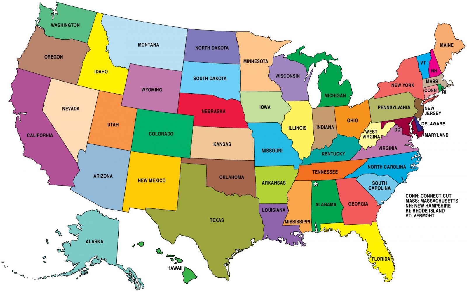
US States

Administratively, the USA includes 50 states and Federal District of Columbia. The states have a fairly large internal sovereignty, having their own flags, laws and so on. On the external arena they are inferior to the federal bodies, having no powers at the state level.
The United States occupies a huge territory and therefore the states located in different parts of the country can differ significantly from one another in various parameters: population, area, income level and so on. Various organizations involved in statistics carry out classification of US states according to certain criteria.
Thus, the Census Bureau subdivides 4 macroregions:
- Norths-East;
- Middle West;
- South;
- West.
- New England;
- Middle Atlantic States;
- Northeastern Central States;
- Northwestern central states;
- South Atlantic states;
- Southeast Central States;
- South-West Central States;
- Mountain States;
- Pacific States.
In addition, it is possible to distinguish the US states based on other criteria.
Population
The largest US state in terms of population is California. Here almost 40 million people live, which is comparable to Spain and other major countries.In addition to California, there are also Texas (27 million people), Florida (21 million people), New York (20 million) and Illinois (13 million people).
The smallest state by population is Wyoming. Here 600 thousand inhabitants live, like in a large regional center of Russia.
Area
There are real giants among the US states by the occupied territories. A world beater is Alaska. This state covers the area of 1.7 million square kilometers. If Alaska would be a separate state, then owing to this parameter it would be included into the top 20 countries of the world.Further, based on the area occupied the following states are singled out: Texas (700 thousand square kilometers), California (420 thousand square kilometers) and Montana (380 thousand square kilometers).
At the other end of the rating there is the state of Rhode Island, it occupies only 4,000 square kilometers, of which land occupies only 67%, the rest is water. The area of Rhode Island is comparable to the territory of Moscow (with suburbs).
Not far from Rhode Island there is Delaware (6.5 thousand square kilometers). Delaware is considered the first state to sign the US Constitution of 1787.
GDP per capita
The level of GDP per capita is an indicator that economists use to determine development of a state or a separate territory and it makes it possible to rank the states as follows :- Delaware - 65.0 thousand dollars per capita;
- Alaska - 60.0 thousand dollars per capita;
- Connecticut - 55.0 thousand dollars per capita;
- Wyoming - 53.0 thousand dollars per capita.
One of the poorest US states is Mississippi (GDP per capita is $ 27.5 thousand), which is comparable to the level of such countries as Kuwait, Spain or South Korea.
Political preferences
In the USA the political preferences of the population are divided into two parts between the Republican Party and the Democratic Party. At the same time, some states almost always support the policy of one party, and some of the other.The following state refer to the most conservative states, in which the support of Republicans is strong:
- Montana;
- Idaho;
- Wyoming;
- North Dakota;
- South Dakota;
- Kansas;
- Oklahoma;
- Texas;
- Missouri;
- Arkansas;
- Louisiana;
- Tennessee;
- Kentucky;
- Indiana;
- West Virginia;
- South Carolina;
- Alaska.
- Washington;
- Oregon;
- California;
- Colorado;
- New Mexico;
- Hawaii;
- Minnesota;
- Michigan;
- Illinois;
- Virginia;
- Maine;
- Vermont;
- Massachusetts;
- Rhode Island;
- New York;
- Pennsylvania;
- Connecticut;
- New Jersey;
- Delaware;
- Maryland;
- Washington, D.C.
- Nevada;
- Utah;
- Arizona;
- Nebraska;
- Iowa;
- Wisconsin;
- Ohio;
- North Carolina;
- Georgia;
- Florida;
- New Hampshire.
To comment on the materials of the portal can only registered users. Log in.


